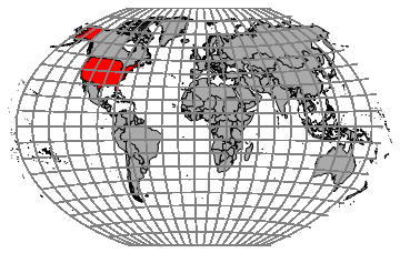
Specifying EdgeForm resolves the country borders. Latitude and longitude...well
here is a clumsy way. Depending on your desired grid you may have to clean up conversion.
myc[name_] := If[name == "UnitedStates", Red, Lighter[Gray]]
lat = Quiet[
   Line /@ Table[
     Table[GeoGridPosition[GeoPosition[{j, k, 0}],
        "WinkelTripel"][[1, {1, 2}]], {j, -90, 90, 5}], {k, -170, 170,
       15}]];
long = Quiet[
   Line /@ Table[
     Table[GeoGridPosition[GeoPosition[{k, j, 0}],
        "WinkelTripel"][[1, {1, 2}]], {j, -170, 170, 15}], {k, -90,
      90, 10}]];
Graphics[{Gray, lat, long, myc[#], EdgeForm[Black],
    CountryData[#, {"FullPolygon", "WinkelTripel"}]} & /@
  CountryData[]]


